Roads were generally built along the outside lines of survey sections. Then they could serve two farmers without crossing anybody’s land. This pattern can be seen in Chicago. Major streets are built on the section lines. Chicago uses 800 house numbers to the mile, so the section line roads are 800 numbers apart.
Thus Chicago Avenue (800 North,) North Avenue (1600 N.,) Fullerton (2400 N.,) Halsted (800 West) and Ashland (1600 W.) are all built on section lines. Other major streets such as Armitage (2000 N.) and Damen (2000 W.) are built on the half section lines. The numbering is not quite as tidy, but major south side streets are also built on section lines. Examples are 47th St., 55th St./Garfield Blvd., 63rd etc.
Several anomalies of the survey process are also apparent in Chicago. For sales purposes, the government wanted each section to be as close to 640 acres, i.e. one square mile, as possible. The curvature of the earth and surveying errors made adjustments necessary. Section lines were moved over a bit.
Straight Dope Chicago discusses how this occurs on North Avenue where most major cross streets take a small jog. Also mentioned is the tilt of the Chicago street grid a little more than one degree west of true north.
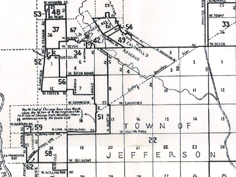
Since Indian Reservations were not for sale by the government, several small reservations in the Chicago area were excluded from the Public Land Survey. An example is the Billy Caldwell Reserve centered on Caldwell and Devon Avenues. It cuts irregularly through several survey sections. Street patterns follow.
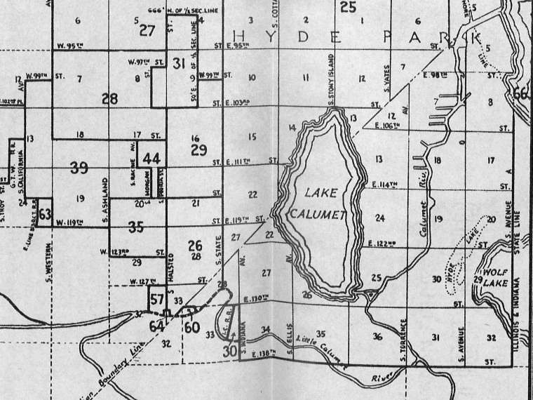
The federal government initially acquired by Indian treaty a corridor about 20 miles wide for the Illinois and Michigan Canal This resulted in an “Indian Boundary Line” on the north and south sides. The initial survey of land inside the Line did not quite meet up with the latter surveys of land outside.
Forest Preserve Drive and Rogers Avenue follow the northern Indian Boundary line. Minor jogs in several streets such as Pulaski are apparent as they cross the Line. The southern Indian Boundary Line passes through a largely industrial area of former marsh, so the Line is not as obvious in the street layout, but is quite dramatic on maps showing survey sections.
Further disruptions in Chicago’s street layout are caused by diagonal streets such as Stony Island and Archer. As Milo Milton Quaife discusses in Chicago's Highways, Old and New, these were mostly old Indian trails.


Add a comment to: Public Land Survey, Continued: Technology That Changed Chicago